


Frontline SMS
| Location | Various |
| Date | 2005-present |
| Client | Various |
| Funder | Various |
| End User | 14 000+ downloads |
| Cost | $1 million |
| Founder | Ken Banks |
| Team | Alex Anderson, Sarah George, Laura Walker Hudson, Ryan Jones, Sean McDonald, Amy O’Donnell, Florence Scialom |
Frontline SMS is free to use. Photo: Loyce Kyogabirwe/FrontlineSMS
Ken Banks refers to himself as a mobile anthropologist. “I can’t possibly understand everyone’s problem, so it’s hard for me to fix them. But what I can do is use my IT skills to support communication for people that can fix problems,” he says. Banks is on the frontline of a movement that is using technology to identify and map community needs by crowd sourcing information that can be responded to by authorities and individuals.
Whether mapping violence in inner cities, preventing health emergencies, or responding to disaster situations, the idea has proven extremely helpful. Together, these technologies are opening the door to to a new approach to urban planning. Call it crowd-sourced urban planning.
In 2005, Banks created FrontlineSMS, responding to a request by the park services in Mozambique and South Africa for tools to facilitate better communication. “I found at the time that most of the tech communication tools were too complicated or relied on the Internet,” Banks recalls. “Based on the experience I had working with NGOs across Southern Africa, I knew most did not have the funds for a tech-IT director, or the luxury of access to the Internet.” Thus, Banks wrote open source software for an intuitive system that could be universally used. “After 14 000 downloads I think we can safely say that the software has been useful,” he says.
One user of FrontlineSMS is Ushahidi, a geographic information system mapping software with a name that means “testimony” in Swahili, was born in response to the 2008 post-election violence in Kenya. Ory Okolloh, one of Ushahidi’s founders and an avid blogger, noticed a disconnect between what individuals were blogging and what the mainstream news and government were reporting of the violence. The mapping visualization platform was developed to allow feeds from different sources such as text messages, Twitter, and YouTube to be organized and mapped in real time, giving community members up-to-date reliable information on potential hotspots.
Ushahidi
| Location | Kenya; all over |
| Date | 2008- present |
| Client | Various |
| Funder | Various |
| End User | Communities around the world |
| Team | Henry Addo, Caleb Bell, Heather Ford, Jon Gosier, Matthew Griffiths, Brian Herbert, Erik Hersman, Emmanuel Kala, Linda Kamau, David Kobia, Ory Okolloh, Ahmed Maawy, Ory Okolloh, Patrick Meier, Charl van Niekerk, Juliana Rotich, Limo Taboi |
| Cost | $900 000 USD |
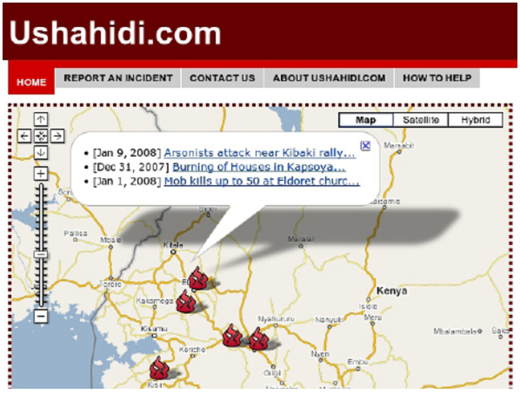
Ushahidi uses community- based mapping to share information. Image: Ushahidi
“We are not just crowd sourcing,” says Patrick Meier, director of crisis mapping and new media at Ushahidi. “Individuals are contributing but are also receiving valuable information.” Ushahidi uses FrontlineSMS software to upload incoming text messages onto their maps. Users can tailor information to their area of interest. “For example, if you programmed a specific map using Ushahidi, anything that gets mapped sends you an automated text message. We hope this helps people make more informed decisions.”
Similarly, other community-based mapping initiatives are allowing citizens to better understand and communicate their needs. Kibera, Kenya, one of the largest slums in Africa, was a blank spot on most maps until November 2009 when young Kiberans created the first free and open digital map of their own community using OpenStreetMap. “Kibera being such a well-known place locally and internationally, yet not represented on the map. Simply, it deserved to be on the map.” With icons, the map denotes important locations such as water sources, hospitals and places of worship. Map Kibera decided to push mapping further and launched Voice of Kibera, using the Ushahidi platform, as a citizen reporting resource. Residents as well as media sources report information about events by text message. They can be anything from cleanup day locations to the fixing of drainage systems. These reports are then geographically visualized on the Kibera map.
OpenStreetMa
| Location | Global |
| Dates | 2004-present |
| End User | Various |
| Funder | Open Street Map Foundation through membership fees and donations |
| Cost | $81 000 USD |
| Founder | Steve Coast |
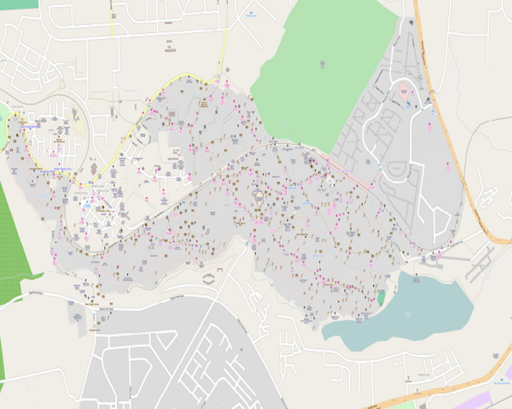
First ever map of the Kenyan slum Kibera with the OpenStreetMap. Image: Map Kibera Trust
Medic Mobile, a technology health organization, has found another application for the FrontlineSMS technology and Ushahidi. After the devastating earthquake in Haiti, Medic Mobile with a dozen other tech-mobile companies, made it possible for people to text to online crowdsourcing platforms with their requests for help.
“The motivation was simply to make the invisible visible, and help the map expand to a blank spot.”
Mikel Maron, Voice of Kibera

READ OR LEAVE A COMMENT