


left: An example of high-rise apartments in an Israeli settlement overlooking Palestinian lands
right: Traditional Palestinian vernacular architecture
| Location | West Bank, Israel |
| Date | 2002–3 |
| Design Team | Rafi Segal, Eyal Weizman |
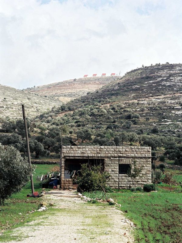
Politics and religion have combined to create a sensitive patchwork of divided territories in Israel’s West Bank.
The conflict has also played out, among other places, on the drawing boards of architects and planners. In 2002 Eyal Weizman and Rafi Segal undertook a study of the physical transformations of the West Bank, documenting the growth patterns of Jewish settlements and Palestinian villages in the disputed territory.
The architects found that ownership policies dating back centuries had resulted in a kind of “vertical planning.” During the time of the Ottoman empire, residents paid tax only on lands they cultivated. Later land that could be proven to be under continuous cultivation reverted to private Palestinian ownership. Lands not privately owned reverted to the state. As a result Palestinian villages were concentrated in the fertile valleys, while Jewish settlements took root on hilltops. After the Six Day War the extension of the occupied territories coincided with the growth of suburbs, creating in the architects’ words an architecture of “civilian occupation.”
Originally the Israel Association of United Architects (IAUA) commissioned the study for the International Union of Architects’ congress in Berlin in 2002. But after the catalogue was completed, the IAUA withdrew its support for the project. The exhibition was canceled and the catalogue banned. Subsequently published by Verso Books and exhibited in New York and Berlin, the work instigated a wide discussion of the conflicted role of architecture within the disputed territories. By mapping the physical transformation of the occupied territories, the architects raised ethical and humanitarian questions about the way roads, water systems, and telephone lines—the everyday elements of urban planning and architecture—had become “tactical tools,” shaping not only the landscape but also the spatial dimensions of the Israeli-Palestinian conflict. Those questions have only increased in significance with the construction by Israel of a proposed 416-mile- (670-km-) barrier between itself and the West Bank.

READ OR LEAVE A COMMENT